
Make a donation
Gear up for your next adventure:
As an Amazon Associate, this site earns from qualifying purchases at no extra cost to you.
Barrage de Roselend topographic map
Click on the map to display elevation.
Make a donation
Gear up for your next adventure:
As an Amazon Associate, this site earns from qualifying purchases at no extra cost to you.
Barrage de Roselend
The dam has a maximum height of 150 m (492 ft) and a length of 804 m (2,638 ft). It is 3 m (10 ft) wide at its crest and 22 m (72 ft) wide at its base. The dam has a structural volume of 945,000 m3 (1,236,013 cu yd). Its reservoir, Lac de Roselend, can store 187,000,000 m3 (151,603 acre⋅ft) of water and has a surface area of 3.2 km2 (1 mi2). Directly over the river bed is the dam's concrete arch with a 215 m (705 ft) radius. Flanking it on either side are concrete buttresses supporting the dam wall. Water from the dam is transferred west via a 13 km (8 mi) long penstock to the underground power station in La Bâthie. At the power station, the water feeds six 91 MW Pelton turbine-generators. The difference in elevation between the power station and reservoir affords a hydraulic head (drop) of 1,250 m (4,101 ft). Water from the St. Guerin Dam, 5 km (3 mi) to the southwest at 45°39′00″N 6°34′46″E / 45.65000°N 6.57944°E / 45.65000; 6.57944 (St. Guerin Dam) and Gittaz Dam, 4.5 km (3 mi) to the northeast at 45°42′40″N 6°38′46″E / 45.71111°N 6.64611°E / 45.71111; 6.64611 (Gittaz Dam), provide additional water to Lac de Roselend as well.
Make a donation
Gear up for your next adventure:
As an Amazon Associate, this site earns from qualifying purchases at no extra cost to you.
About this map
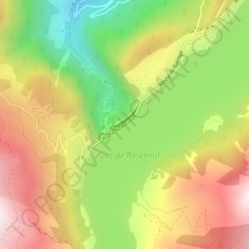
Name: Barrage de Roselend topographic map, elevation, terrain.
Average elevation: 1,598 m
Minimum elevation: 1,159 m
Maximum elevation: 2,033 m
Make a donation
Gear up for your next adventure:
As an Amazon Associate, this site earns from qualifying purchases at no extra cost to you.