
Beerfelden topographic map
Click on the map to display elevation.
Beerfelden
Beerfelden lies in the Odenwald at elevations from 330 to 540 m. Towards the south stretches the narrow, wooded Gammelsbach Valley, in which are found the Freienstein castle ruins, down to the Neckar.
About this map
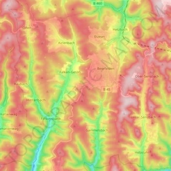
Name: Beerfelden topographic map, elevation, terrain.
Location: Beerfelden, Oberzent, Odenwaldkreis, Hesse, 64760, Germany (49.50141 8.87295 49.61080 9.04773)
Average elevation: 404 m
Minimum elevation: 186 m
Maximum elevation: 566 m