Geolocate

Valcieca topographic map

Click on the map to display elevation.

About this map
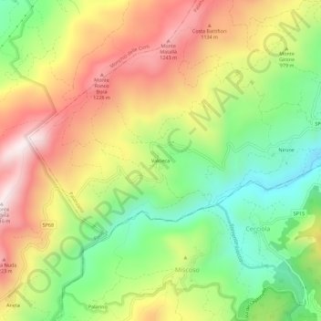
Name: Valcieca topographic map, elevation, terrain.

Location: Valcieca, Palanzano, Parma, Emilia-Romagna, Italia (44.37074 10.15044 44.41074 10.19044)

Average elevation: 941 m

Minimum elevation: 619 m

Maximum elevation: 1,301 m

Gear up for your next adventure:

🔥Camping Stove - Portable stoves to cook outdoors with ease
🐕Hiking Dog Pack - Let your canine companion carry their own water and food
🛰️Satellite Messenger - Emergency communication for areas with no cell service
🧭Orienteering Kit - Tools for map reading and navigation in the wild
🧶550 Survival Paracord - Versatile utility cord for emergency repairs and rigging

As an Amazon Associate, this site earns from qualifying purchases at no extra cost to you.