Geolocate

Sabanal topographic map

Click on the map to display elevation.

About this map

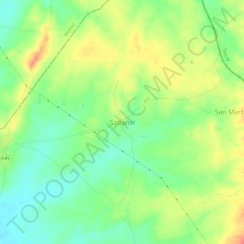
Name: Sabanal topographic map, elevation, terrain.

Location: Sabanal, Tuchín, Sabanas, Córdoba, RAP Caribe, Colombia (9.23710 -75.59409 9.27710 -75.55409)

Average elevation: 47 m

Minimum elevation: 24 m

Maximum elevation: 74 m

Gear up for your next adventure:

🔭Outdoor Binoculars - Lightweight binoculars for birdwatching and hiking
🧢Outdoor Cap - Protective cap for sun and rain during hikes
🛰️Satellite Messenger - Emergency communication for areas with no cell service
🧶550 Survival Paracord - Versatile utility cord for emergency repairs and rigging
🥫Freeze-Dried Meals - Lightweight, high-calorie nutrition for multi-day treks

As an Amazon Associate, this site earns from qualifying purchases at no extra cost to you.