Geolocate

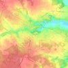
Le Porge topographic map

Click on the map to display elevation.

About this map

Name: Le Porge topographic map, elevation, terrain.

Location: Le Porge, Lesparre-Médoc, Gironde, Nouvelle-Aquitaine, Metropolitan France, 33680, France (44.80841 -1.23301 44.92157 -1.03725)

Average elevation: 21 m

Minimum elevation: 2 m

Maximum elevation: 49 m

Other topographic maps

Click on a map to view its topography, its elevation and its terrain.

Cité du Quillet

France > Nouvelle-Aquitaine > Gironde > Bazas

Average elevation: 102 m

Gear up for your next adventure:

🥫Freeze-Dried Meals - Lightweight, high-calorie nutrition for multi-day treks
⛺Family Camping Tent - Spacious tent suitable for family camping trips
🧳Compression Sacks - Maximize space in your backpack by shrinking gear
🧣Evaporative Cooling Towel - Beat the heat during intense summer climbs
🥾Waterproof Trail Shoes - Shoes designed to handle wet terrain

As an Amazon Associate, this site earns from qualifying purchases at no extra cost to you.