Geolocate

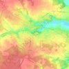
Le Porge topographic map

Click on the map to display elevation.

About this map

Name: Le Porge topographic map, elevation, terrain.

Location: Le Porge, Lesparre-Médoc, Gironde, Nouvelle-Aquitaine, Metropolitan France, 33680, France (44.80841 -1.23301 44.92157 -1.03725)

Average elevation: 21 m

Minimum elevation: 2 m

Maximum elevation: 49 m

Other topographic maps

Click on a map to view its topography, its elevation and its terrain.

Cité du Quillet

France > Nouvelle-Aquitaine > Gironde > Bazas

Average elevation: 102 m

Gear up for your next adventure:

🩹Moleskin Blister Pads - Direct protection for painful foot pressure points
🚲MTB Frame Bag - Carry tools and maps directly on your bicycle frame
🕯️Camping Lantern - Illuminates your entire campsite with high-efficiency LEDs
🥾Approach Boots - Comfortable boots for hiking and climbing approaches
🛏️Camping Sleeping Mat - Comfortable mats for sleeping outdoors

As an Amazon Associate, this site earns from qualifying purchases at no extra cost to you.