Geolocate

Sedalia topographic map

Click on the map to display elevation.

About this map

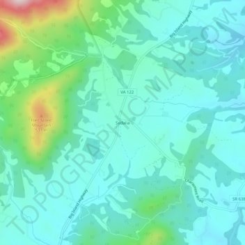
Name: Sedalia topographic map, elevation, terrain.

Location: Sedalia, Bedford County, Virginia, 24526, United States (37.46764 -79.46031 37.50764 -79.42031)

Average elevation: 337 m

Minimum elevation: 256 m

Maximum elevation: 664 m

Other topographic maps

Click on a map to view its topography, its elevation and its terrain.

Elk Creek

United States > Virginia > Bedford County

Average elevation: 220 m

Bedford

United States > Virginia > Bedford County

Average elevation: 285 m

Gear up for your next adventure:

Camping Groundsheet - Protect your tent from moisture and dirt
🕶️Polarized Sunglasses - Protect your eyes with durable polarized lenses
👟Sport Hiking Sandals - Breathable footwear for water crossings and camp rest
🥾Light Trekking Boots - Supportive boots for multi-day treks
🥾Mountaineering Boots - Supportive boots for climbing and high-altitude hiking

As an Amazon Associate, this site earns from qualifying purchases at no extra cost to you.