Geolocate

Mazet topographic map

Click on the map to display elevation.

About this map
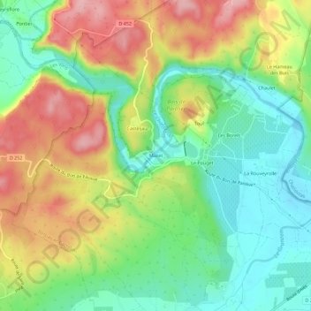
Name: Mazet topographic map, elevation, terrain.

Location: Mazet, Casteljau, Berrias-et-Casteljau, Largentière, Ardèche, Auvergne-Rhône-Alpes, France métropolitaine, 07460, France (44.37673 4.17979 44.41673 4.21979)

Average elevation: 171 m

Minimum elevation: 109 m

Maximum elevation: 254 m

Other topographic maps

Click on a map to view its topography, its elevation and its terrain.
Gear up for your next adventure:

🔭Compact Monocular - One-handed bird watching and trail spotting
🥫Freeze-Dried Meals - Lightweight, high-calorie nutrition for multi-day treks
🧥Waterproof Jacket - Lightweight rain jackets for hiking and outdoor activities
🧤Thermal Hiking Gloves - Grip-enhanced gloves for cold-weather altitude trekking
🧥Ultralight Puffy Jacket - Maximum warmth that packs down to the size of an orange

As an Amazon Associate, this site earns from qualifying purchases at no extra cost to you.