
Thank you for supporting this site ❤️
Make a donation
Make a donation
Gear up for your next adventure:
As an Amazon Associate, this site earns from qualifying purchases at no extra cost to you.
Crestena topographic map
Click on the map to display elevation.
Thank you for supporting this site ❤️
Make a donation
Make a donation
Gear up for your next adventure:
As an Amazon Associate, this site earns from qualifying purchases at no extra cost to you.
About this map
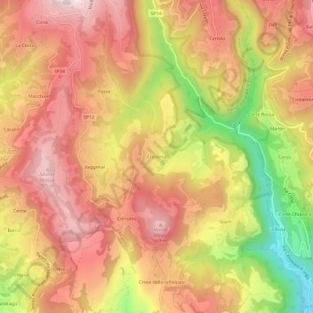
Name: Crestena topographic map, elevation, terrain.
Location: Crestena, Sant'Anna d'Alfaedo, Verona, Veneto, 37020, Italia (45.58529 10.94297 45.62529 10.98297)
Average elevation: 715 m
Minimum elevation: 336 m
Maximum elevation: 956 m
Thank you for supporting this site ❤️
Make a donation
Make a donation
Gear up for your next adventure:
As an Amazon Associate, this site earns from qualifying purchases at no extra cost to you.