
Holyrood Park topographic map
Interactive map
Click on the map to display elevation.
About this map
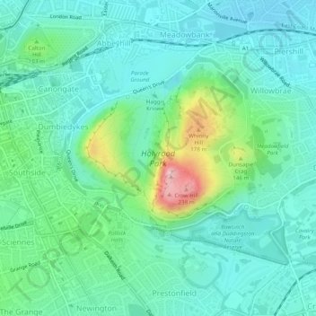
Name: Holyrood Park topographic map, elevation, terrain.
Location: Holyrood Park, Édimbourg, Écosse, EH8 8HG, Royaume-Uni (55.93650 -3.17865 55.95478 -3.14383)
Average elevation: 69 m
Minimum elevation: 18 m
Maximum elevation: 239 m