Geolocate

City topographic map

Click on the map to display elevation.

About this map

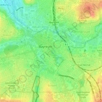
Name: City topographic map, elevation, terrain.

Location: City, Bayreuth, Bavaria, 95444, Germany (49.93567 11.56976 49.94733 11.58646)

Average elevation: 348 m

Minimum elevation: 327 m

Maximum elevation: 369 m

Gear up for your next adventure:

🔋Emergency Crank Radio - Weather alerts and power without needing batteries
💡Portable Camping Lamp - Rechargeable lamp for campsite lighting
🔭Outdoor Binoculars - Lightweight binoculars for birdwatching and hiking
🛶Canoe Life Vest - Safety vest for water sports
🌬️Windproof Camp Stove - Efficient cooking even on exposed mountain peaks

As an Amazon Associate, this site earns from qualifying purchases at no extra cost to you.