Geolocate

Sanchore topographic map

Click on the map to display elevation.

About this map

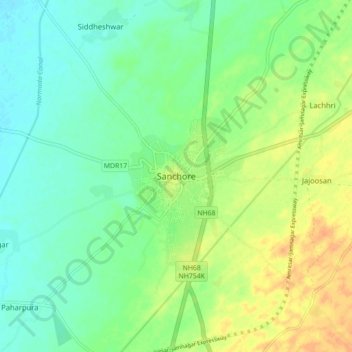
Name: Sanchore topographic map, elevation, terrain.

Location: Sanchore, Sanchore Tehsil, Sanchore District, Rajasthan, 343041, India (24.71339 71.73201 24.79339 71.81201)

Average elevation: 56 m

Minimum elevation: 42 m

Maximum elevation: 78 m

Gear up for your next adventure:

🧥Ultralight Puffy Jacket - Maximum warmth that packs down to the size of an orange
🥾Hiking Shoes - Durable and comfortable shoes for trail hiking
🪜Heavy Duty Carabiners - Multi-use clips for securing gear to your backpack
🥾Lightweight Hiking Boots - Boots for comfort and mobility on long hikes
🎒Hiking Daypack - Lightweight and durable backpacks for day trips and excursions

As an Amazon Associate, this site earns from qualifying purchases at no extra cost to you.