
Sugar Land topographic map
Click on the map to display elevation.
Sugar Land
Sugar Land is located in northeast Fort Bend County, 20 miles (32 km) southwest of downtown Houston. It is bordered by Houston to the northeast, and by Stafford, Missouri City, and Meadows Place to the east. According to the United States Census Bureau, the city of Sugar Land has a total area of 42.9 square miles (111.1 km2), of which 40.5 square miles (104.8 km2) are land and 2.4 square miles (6.3 km2), or 5.7%, are covered by water. The elevation of most of the city is between 70 and 90 feet (21 and 27 m) above sea level. The elevation of Sugar Land Regional Airport (SGR) is 82 feet (25 m).
About this map
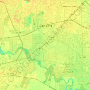
Name: Sugar Land topographic map, elevation, terrain.
Location: Sugar Land, Fort Bend County, Texas, United States (29.51252 -95.69811 29.66187 -95.58050)
Average elevation: 24 m
Minimum elevation: 8 m
Maximum elevation: 33 m