Geolocate

Campo topographic map

Click on the map to display elevation.

About this map

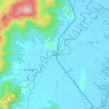
Name: Campo topographic map, elevation, terrain.

Location: Campo, Bacuag, Surigao del Norte, Caraga, 8408, Philippines (9.55797 125.62008 9.59797 125.66008)

Average elevation: 42 m

Minimum elevation: 2 m

Maximum elevation: 276 m

Gear up for your next adventure:

🥾Light Trekking Boots - Supportive boots for multi-day treks
🧶550 Survival Paracord - Versatile utility cord for emergency repairs and rigging
🧦Merino Wool Socks - Moisture-wicking comfort for long-distance hiking
🔪Outdoor Multitool - Versatile tool for repairs and food prep in the wild
🕶️Polarized Sunglasses - Protect your eyes with durable polarized lenses

As an Amazon Associate, this site earns from qualifying purchases at no extra cost to you.