Geolocate

Gul topographic map

Click on the map to display elevation.

About this map

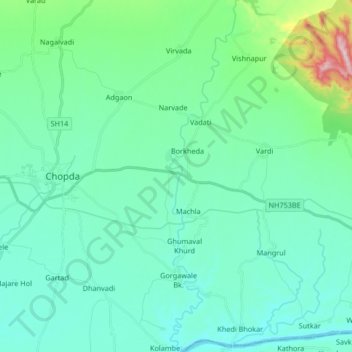
Name: Gul topographic map, elevation, terrain.

Location: Gul, Ambade, Chopda, Jalgaon, Maharashtra, India (21.16942 75.34949 21.32429 75.38086)

Average elevation: 214 m

Minimum elevation: 144 m

Maximum elevation: 570 m

Gear up for your next adventure:

💧Reusable Water Bottle - Durable water bottles for hydration on trails
🧊Insulated Water Bottle - Keeps drinks cold in summer and prevents freezing in winter
🛏️Sleeping Bag - Warm and compact sleeping bags for outdoor camping
📷Outdoor Action Camera - Capture high-elevation views and rugged adventures
🧦Outdoor Socks - Durable socks designed for hiking and outdoor sports

As an Amazon Associate, this site earns from qualifying purchases at no extra cost to you.