Geolocate

Tobin Lake topographic map

Click on the map to display elevation.

About this map

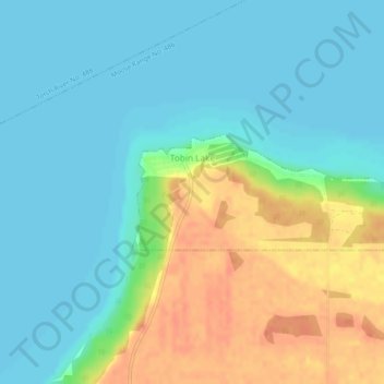
Name: Tobin Lake topographic map, elevation, terrain.

Location: Tobin Lake, Division No. 14, Saskatchewan, Canada (53.51094 -103.74965 53.51950 -103.70190)

Average elevation: 323 m

Minimum elevation: 309 m

Maximum elevation: 351 m

Division No. 14 trails, hiking, mountain biking, running and outdoor activities

Other topographic maps

Click on a map to view its topography, its elevation and its terrain.

Garrick

Canada > Saskatchewan > Division No. 14

Average elevation: 429 m

Gear up for your next adventure:

🧊Portable Cooler - Keep food and drinks cold during outdoor adventures
🧶550 Survival Paracord - Versatile utility cord for emergency repairs and rigging
🥾Trail Hiking Socks - Comfortable socks to prevent blisters and fatigue
🧭Orienteering Kit - Tools for map reading and navigation in the wild
🏃Hydration Running Vest - Carry water and maps close to your body for speed

As an Amazon Associate, this site earns from qualifying purchases at no extra cost to you.