Geolocate

Montgat topographic map

Click on the map to display elevation.

About this map
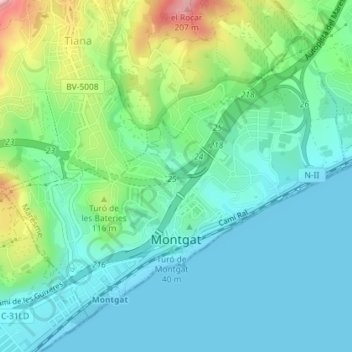
Name: Montgat topographic map, elevation, terrain.

Location: Montgat, Maresme, Barcelona, Catalonia, 08390, Spain (41.46063 2.26111 41.48248 2.29645)

Average elevation: 53 m

Minimum elevation: 0 m

Maximum elevation: 207 m

Gear up for your next adventure:

🥾Trail Running Boots - Durable shoes designed for trail running
🗺️Topographic Maps - Detailed maps to explore trails, mountains, and wilderness areas
🧼Biodegradable Camp Soap - Environmentally friendly cleaning for gear and body
💧Reusable Water Bottle - Durable water bottles for hydration on trails
🦌Outdoor Trail Camera - Monitor wildlife activity near your favorite spots

As an Amazon Associate, this site earns from qualifying purchases at no extra cost to you.