Geolocate

Eltham topographic map

Click on the map to display elevation.

About this map

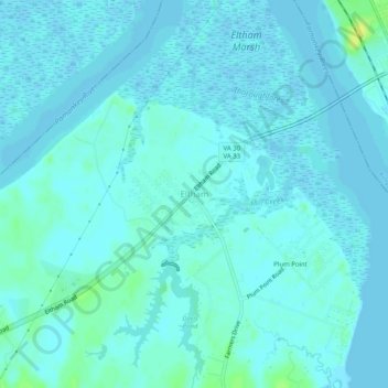
Name: Eltham topographic map, elevation, terrain.

Location: Eltham, New Kent County, Virginia, 23181, United States (37.50376 -76.84607 37.54376 -76.80607)

Average elevation: 3 m

Minimum elevation: -4 m

Maximum elevation: 17 m

Gear up for your next adventure:

🛏️Sleeping Bag - Warm and compact sleeping bags for outdoor camping
🔋Solar Power Bank - Keep your GPS and devices charged during long outdoor trips
💧Collapsible Water Bottle - Space-saving water bottle for outdoor activities
🥘Camping Cookware Set - Compact nesting pots and pans for trail cooking
🥾Waterproof Hiking Boots - Essential footwear for rugged terrain and wet Canadian trails

As an Amazon Associate, this site earns from qualifying purchases at no extra cost to you.