Geolocate

Sector Piedras topographic map

Click on the map to display elevation.

About this map

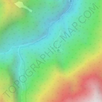
Name: Sector Piedras topographic map, elevation, terrain.

Location: Sector Piedras, Santa Marta, Magdalena, RAP Caribe, Colombia (11.02679 -73.93688 11.04679 -73.91688)

Average elevation: 1,397 m

Minimum elevation: 863 m

Maximum elevation: 2,315 m

Other topographic maps

Click on a map to view its topography, its elevation and its terrain.

Santa Marta

Colombia > Magdalena > Santa Marta

Average elevation: 214 m

Santa Marta

Colombia > Magdalena > Santa Marta

Average elevation: 214 m

Arrecifes Beach

Colombia > Magdalena > Santa Marta

Average elevation: 31 m

Gear up for your next adventure:

💧Hydration Pack - Hands-free hydration system for long hikes
💧Collapsible Water Bottle - Space-saving water bottle for outdoor activities
Lightweight Camping Tent - Portable shelter optimized for Canadian backcountry camping
🥾Mountaineering Boots - Supportive boots for climbing and high-altitude hiking
🥾Waterproof Hiking Boots - Boots keeping your feet dry in wet conditions

As an Amazon Associate, this site earns from qualifying purchases at no extra cost to you.