Geolocate

Våg topographic map

Click on the map to display elevation.

About this map

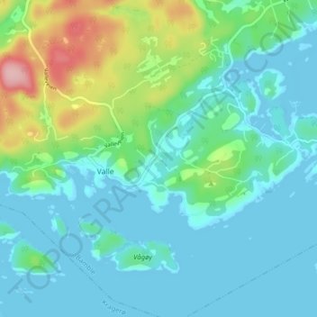
Name: Våg topographic map, elevation, terrain.

Location: Våg, Valle, Bamble, Vestfold og Telemark, 3967, Norway (58.91404 9.55123 58.95404 9.59123)

Average elevation: 34 m

Minimum elevation: -2 m

Maximum elevation: 159 m

Gear up for your next adventure:

🧴Sunscreen SPF - Broad-spectrum sunscreen for outdoor activities
🧥Softshell Hiking Jacket - The perfect balance of wind protection and breathability
🧭GPS Tracker - Track your location in remote areas safely
🔋Solar Power Bank - Keep your GPS and devices charged during long outdoor trips
🧤Insulated Winter Gloves - Heavy-duty protection for sub-zero Canadian adventures

As an Amazon Associate, this site earns from qualifying purchases at no extra cost to you.