
Thank you for supporting this site ❤️
Make a donation
Make a donation
Gear up for your next adventure:
As an Amazon Associate, this site earns from qualifying purchases at no extra cost to you.
Gölardı topographic map
Click on the map to display elevation.
Thank you for supporting this site ❤️
Make a donation
Make a donation
Gear up for your next adventure:
As an Amazon Associate, this site earns from qualifying purchases at no extra cost to you.
About this map
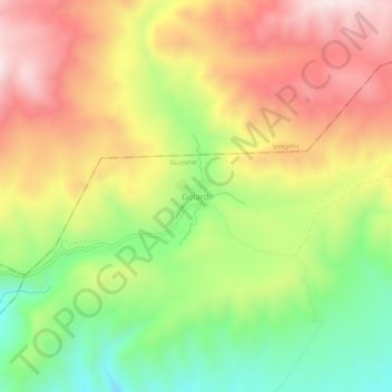
Name: Gölardı topographic map, elevation, terrain.
Location: Gölardı, Gürpınar, Van, Eastern Anatolia Region, Turkey (38.41228 43.53005 38.45228 43.57005)
Average elevation: 2,400 m
Minimum elevation: 2,105 m
Maximum elevation: 2,696 m
Thank you for supporting this site ❤️
Make a donation
Make a donation
Gear up for your next adventure:
As an Amazon Associate, this site earns from qualifying purchases at no extra cost to you.