
Thank you for supporting this site ❤️
Make a donation
Make a donation
Gear up for your next adventure:
As an Amazon Associate, this site earns from qualifying purchases at no extra cost to you.
Ebersberg topographic map
Click on the map to display elevation.
Thank you for supporting this site ❤️
Make a donation
Make a donation
Gear up for your next adventure:
As an Amazon Associate, this site earns from qualifying purchases at no extra cost to you.
About this map
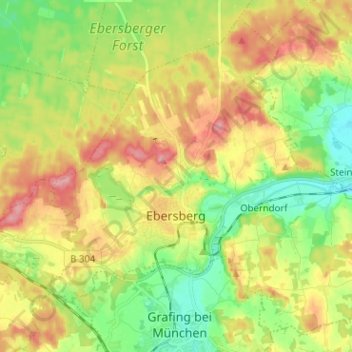
Name: Ebersberg topographic map, elevation, terrain.
Location: Ebersberg, Landkreis Ebersberg, Bavaria, 85560, Germany (48.04791 11.91948 48.12431 12.04632)
Average elevation: 560 m
Minimum elevation: 510 m
Maximum elevation: 623 m
Thank you for supporting this site ❤️
Make a donation
Make a donation
Gear up for your next adventure:
As an Amazon Associate, this site earns from qualifying purchases at no extra cost to you.