
Andres Avelino Caceres Dorregaray topographic map
Interactive map
Click on the map to display elevation.
About this map
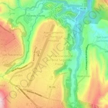
Name: Andres Avelino Caceres Dorregaray topographic map, elevation, terrain.
Average elevation: 2,687 m
Minimum elevation: 2,532 m
Maximum elevation: 2,864 m
Other topographic maps
Click on a map to view its topography, its elevation and its terrain.
Huatata
Perú > Ayacucho > Andres Avelino Caceres Dorregaray
Huatata, Andres Avelino Caceres Dorregaray, Huamanga, Ayacucho, 05002, Perú
Average elevation: 2,752 m