Geolocate

Obira topographic map

Click on the map to display elevation.

About this map
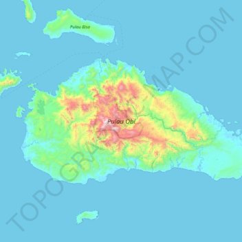
Name: Obira topographic map, elevation, terrain.

Location: Obira, Halmahera Selatan, North Maluku, Maluku, Indonesia (-1.73786 127.39181 -1.33071 128.16820)

Average elevation: 118 m

Minimum elevation: 0 m

Maximum elevation: 1,537 m

Other topographic maps

Click on a map to view its topography, its elevation and its terrain.

Mandaong

Indonesia > North Maluku > Halmahera Selatan

Average elevation: 29 m

Gear up for your next adventure:

❄️Traction Ice Cleats - Slip-on spikes for icy trails and winter hiking
🥫Freeze-Dried Meals - Lightweight, high-calorie nutrition for multi-day treks
🚲MTB Frame Bag - Carry tools and maps directly on your bicycle frame
🎒Hiking Daypack - Lightweight and durable backpacks for day trips and excursions
⛺Camping Essentials - All-in-one gear for a comfortable camping trip

As an Amazon Associate, this site earns from qualifying purchases at no extra cost to you.