Geolocate

Belwali topographic map

Click on the map to display elevation.

About this map

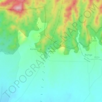
Name: Belwali topographic map, elevation, terrain.

Location: Belwali, Morni, Panchkula, Haryana, 134103, India (30.64982 76.93205 30.68982 76.97205)

Average elevation: 411 m

Minimum elevation: 350 m

Maximum elevation: 555 m

Other topographic maps

Click on a map to view its topography, its elevation and its terrain.

Sherla taal

India > Haryana > Morni

Average elevation: 990 m

Gear up for your next adventure:

🧥Thermal Layer - Insulating layer for cold outdoor conditions
Bushcraft Tarp - Versatile emergency shelter or gear protection
🧭Orienteering Kit - Tools for map reading and navigation in the wild
🩹Moleskin Blister Pads - Direct protection for painful foot pressure points
🥾Light Hiking Boots - Lightweight and comfortable boots for day hikes

As an Amazon Associate, this site earns from qualifying purchases at no extra cost to you.