
Thank you for supporting this site ❤️
Make a donation
Make a donation
Gear up for your next adventure:
As an Amazon Associate, this site earns from qualifying purchases at no extra cost to you.
Temennotte topographic map
Click on the map to display elevation.
Thank you for supporting this site ❤️
Make a donation
Make a donation
Gear up for your next adventure:
As an Amazon Associate, this site earns from qualifying purchases at no extra cost to you.
About this map
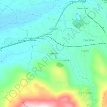
Name: Temennotte topographic map, elevation, terrain.
Location: Temennotte, Sant'Agapito, Isernia, Molise, 86075, Italia (41.53921 14.18675 41.57921 14.22675)
Average elevation: 440 m
Minimum elevation: 281 m
Maximum elevation: 904 m
Thank you for supporting this site ❤️
Make a donation
Make a donation
Gear up for your next adventure:
As an Amazon Associate, this site earns from qualifying purchases at no extra cost to you.