Geolocate

Topolc topographic map

Click on the map to display elevation.

About this map

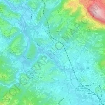
Name: Topolc topographic map, elevation, terrain.

Location: Topolc, Ilirska Bistrica, 6250, Slovenia (45.56341 14.19588 45.60341 14.23588)

Average elevation: 438 m

Minimum elevation: 386 m

Maximum elevation: 649 m

Gear up for your next adventure:

🧊Insulated Water Bottle - Keeps drinks cold in summer and prevents freezing in winter
🔋Lithium AA Batteries - Long-lasting power that performs in extreme cold
👖Convertible Hiking Pants - Zip-off legs to adapt to changing weather conditions
🥽Outdoor Goggles - Protective eyewear for outdoor activities
🔭Outdoor Binoculars - Lightweight binoculars for birdwatching and hiking

As an Amazon Associate, this site earns from qualifying purchases at no extra cost to you.