
Zugspitze topographic map
Interactive map
Click on the map to display elevation.
About this map
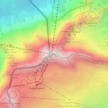
Name: Zugspitze topographic map, elevation, terrain.
Average elevation: 2,300 m
Minimum elevation: 1,513 m
Maximum elevation: 2,952 m
De Zugspitze is met 2962 meter hoogte de hoogste berg van Duitsland en ligt in Zuid-Beieren, op de grens met Oostenrijk.