
Tebet topographic map
Interactive map
Click on the map to display elevation.
About this map
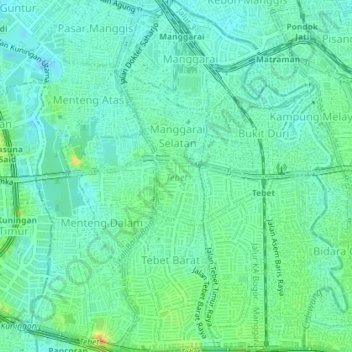
Name: Tebet topographic map, elevation, terrain.
Location: Tebet, Jakarta Selatan, Jakarta, Indonésie (-6.24330 106.83470 -6.20755 106.86697)
Average elevation: 17 m
Minimum elevation: 7 m
Maximum elevation: 42 m
Other topographic maps
Click on a map to view its topography, its elevation and its terrain.
Kanal Banjir Barat
Kanal Banjir Barat, Setiabudi, Jakarta Selatan, Jakarta, 12980, Indonésie
Average elevation: 13 m