Geolocate

Guérignan topographic map

Click on the map to display elevation.

About this map

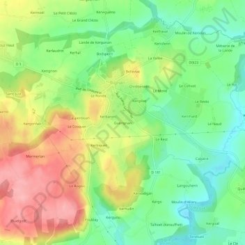
Name: Guérignan topographic map, elevation, terrain.

Location: Guérignan, Bignan, Pontivy, Morbihan, Bretagne, France métropolitaine, 56500, France (47.85333 -2.79054 47.89333 -2.75054)

Average elevation: 116 m

Minimum elevation: 64 m

Maximum elevation: 182 m

Other topographic maps

Click on a map to view its topography, its elevation and its terrain.

Gear up for your next adventure:

🧥Waterproof Jacket - Lightweight rain jackets for hiking and outdoor activities
🧢Sun Protection Cap - Breathable cap to protect from sun exposure
🥾Mountain Hiking Shoes - Shoes with superior grip for mountainous terrain
🦌Outdoor Trail Camera - Monitor wildlife activity near your favorite spots
🩹Moleskin Blister Pads - Direct protection for painful foot pressure points

As an Amazon Associate, this site earns from qualifying purchases at no extra cost to you.