Geolocate

Lac Valiquette topographic map

Click on the map to display elevation.

About this map

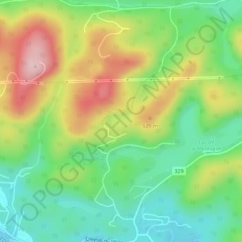
Name: Lac Valiquette topographic map, elevation, terrain.

Location: Lac Valiquette, Saint-Adolphe-d'Howard, Les Pays-d'en-Haut, Laurentides, Quebec, Canada (45.99218 -74.33458 45.99371 -74.33109)

Average elevation: 454 m

Minimum elevation: 359 m

Maximum elevation: 594 m

Les Pays-d'en-Haut trails, hiking, mountain biking, running and outdoor activities

Other topographic maps

Click on a map to view its topography, its elevation and its terrain.

Gear up for your next adventure:

🥾Lightweight Hiking Boots - Boots for comfort and mobility on long hikes
Tent Footprint - Protect tent floor and increase durability
Camping Essentials - All-in-one gear for a comfortable camping trip
🔋Lithium AA Batteries - Long-lasting power that performs in extreme cold
🛶Waterproof Dry Bags - Keep electronics and clothes dry during river crossings

As an Amazon Associate, this site earns from qualifying purchases at no extra cost to you.