Geolocate

Brooklet topographic map

Click on the map to display elevation.

About this map

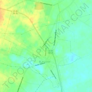
Name: Brooklet topographic map, elevation, terrain.

Location: Brooklet, Bulloch County, Georgia, United States (32.36631 -81.68544 32.40664 -81.64489)

Average elevation: 49 m

Minimum elevation: 37 m

Maximum elevation: 65 m

Other topographic maps

Click on a map to view its topography, its elevation and its terrain.

Denmark

United States > Georgia > Bulloch County

Average elevation: 45 m

Portal

United States > Georgia > Bulloch County

Average elevation: 85 m

Gear up for your next adventure:

🥾Mountaineering Boots - Supportive boots for climbing and high-altitude hiking
🥾Mountain Hiking Shoes - Shoes with superior grip for mountainous terrain
💧Reusable Water Bottle - Durable water bottles for hydration on trails
🧥Insulated Jacket - Keep warm in cold outdoor conditions
🛶Canoe Life Vest - Safety vest for water sports

As an Amazon Associate, this site earns from qualifying purchases at no extra cost to you.