Geolocate

Lahun topographic map

Click on the map to display elevation.

About this map

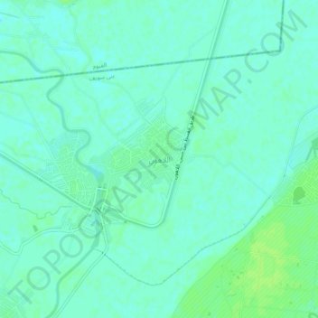
Name: Lahun topographic map, elevation, terrain.

Location: Lahun, Bani Sweif, Egypt (29.18951 30.95954 29.22951 30.99954)

Average elevation: 27 m

Minimum elevation: 23 m

Maximum elevation: 33 m

Other topographic maps

Click on a map to view its topography, its elevation and its terrain.

New Bani Suef City

Egypt > Bani Sweif

Average elevation: 60 m

Al Mermah Bahary

Egypt > Bani Sweif

Average elevation: 31 m

Al Fashn

Egypt > Bani Sweif

Average elevation: 39 m

Tizmant East Village

Egypt > Bani Sweif

Average elevation: 30 m

Beba

Egypt > Bani Sweif

Average elevation: 34 m

Gear up for your next adventure:

💡LED Camping Lantern - Illuminate your campsite with long-lasting lanterns
🧦Merino Wool Socks - Moisture-wicking comfort for long-distance hiking
🏕️Camping Hammock - Integrated protection for sleeping between trees
🔥Camping Stove - Portable stoves to cook outdoors with ease
💧Reusable Water Bottle - Durable water bottles for hydration on trails

As an Amazon Associate, this site earns from qualifying purchases at no extra cost to you.