
Thank you for supporting this site ❤️
Make a donation
Make a donation
Gear up for your next adventure:
As an Amazon Associate, this site earns from qualifying purchases at no extra cost to you.
Mangala topographic map
Click on the map to display elevation.
Thank you for supporting this site ❤️
Make a donation
Make a donation
Gear up for your next adventure:
As an Amazon Associate, this site earns from qualifying purchases at no extra cost to you.
About this map
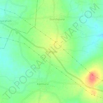
Name: Mangala topographic map, elevation, terrain.
Location: Mangala, Hanur taluk, Chamarajanagar, Karnataka, 571443, India (12.10236 77.22755 12.14236 77.26755)
Average elevation: 688 m
Minimum elevation: 664 m
Maximum elevation: 728 m
Thank you for supporting this site ❤️
Make a donation
Make a donation
Gear up for your next adventure:
As an Amazon Associate, this site earns from qualifying purchases at no extra cost to you.