Geolocate

Tangshan topographic map

Click on the map to display elevation.

About this map

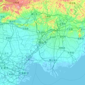
Name: Tangshan topographic map, elevation, terrain.

Location: Tangshan, Hebei, China (38.77375 117.49741 40.46326 119.54704)

Average elevation: 90 m

Minimum elevation: -4 m

Maximum elevation: 1,368 m

Other topographic maps

Click on a map to view its topography, its elevation and its terrain.

Zhangbei

China > Hebei > Zhangbei

Average elevation: 1,439 m

Gear up for your next adventure:

❄️Traction Ice Cleats - Slip-on spikes for icy trails and winter hiking
🧥Thermal Fleece Jacket - Versatile insulation for changing mountain temperatures
💡Solar Camping Lamp - Eco-friendly lighting for campsites
🥾Lightweight Hiking Shoes - Comfortable shoes for day hikes
🧢Hiking Sun Hat - Wide-brimmed protection for exposed mountain ridges

As an Amazon Associate, this site earns from qualifying purchases at no extra cost to you.