
Thank you for supporting this site ❤️
Make a donation
Make a donation
Gear up for your next adventure:
As an Amazon Associate, this site earns from qualifying purchases at no extra cost to you.
Uçarı topographic map
Click on the map to display elevation.
Thank you for supporting this site ❤️
Make a donation
Make a donation
Gear up for your next adventure:
As an Amazon Associate, this site earns from qualifying purchases at no extra cost to you.
About this map
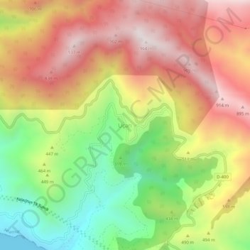
Name: Uçarı topographic map, elevation, terrain.
Location: Uçarı, Anamur, Mersin, Mediterranean Region, Turkey (36.07392 32.60874 36.11392 32.64874)
Average elevation: 502 m
Minimum elevation: 0 m
Maximum elevation: 963 m
Thank you for supporting this site ❤️
Make a donation
Make a donation
Gear up for your next adventure:
As an Amazon Associate, this site earns from qualifying purchases at no extra cost to you.