Geolocate

Town topographic map

Click on the map to display elevation.

About this map

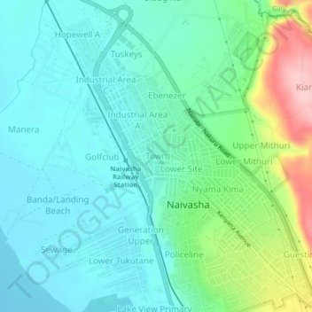
Name: Town topographic map, elevation, terrain.

Location: Town, Viwandani ward, Naivasha, Nakuru, Rift Valley, Kenya (-0.73617 36.41468 -0.69617 36.45468)

Average elevation: 1,929 m

Minimum elevation: 1,882 m

Maximum elevation: 2,079 m

Gear up for your next adventure:

🌬️Windproof Camp Stove - Efficient cooking even on exposed mountain peaks
🛏️Camping Sleeping Mat - Comfortable mats for sleeping outdoors
🧥Thermal Fleece Jacket - Versatile insulation for changing mountain temperatures
🥾Waterproof Hiking Boots - Essential footwear for rugged terrain and wet Canadian trails
🔭Compact Binoculars - Lightweight optics for scouting trails and wildlife

As an Amazon Associate, this site earns from qualifying purchases at no extra cost to you.