Geolocate

Castelo topographic map

Click on the map to display elevation.

About this map

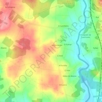
Name: Castelo topographic map, elevation, terrain.

Location: Castelo, Trazo, Ordes, La Coruña, Galicia, España (42.99232 -8.48577 43.02722 -8.45373)

Average elevation: 271 m

Minimum elevation: 220 m

Maximum elevation: 323 m

Other topographic maps

Click on a map to view its topography, its elevation and its terrain.

O Valo

España > Galicia > Ordes > Castelo

Average elevation: 260 m

Gear up for your next adventure:

🧼Biodegradable Camp Soap - Environmentally friendly cleaning for gear and body
💡Portable Camping Lamp - Rechargeable lamp for campsite lighting
🥾Trekking Poles - Adjustable trekking poles to reduce knee stress and improve stability
🥾Waterproof Trail Shoes - Shoes designed to handle wet terrain
💧Reusable Water Bottle - Durable water bottles for hydration on trails

As an Amazon Associate, this site earns from qualifying purchases at no extra cost to you.