Geolocate

Vulcan Mountain topographic map

Click on the map to display elevation.

About this map

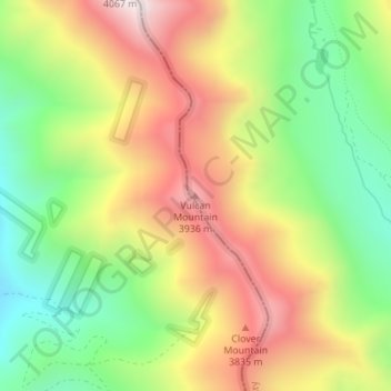
Name: Vulcan Mountain topographic map, elevation, terrain.

Location: Vulcan Mountain, Chaffee County, Colorado, United States (38.57689 -106.35119 38.57699 -106.35109)

Average elevation: 3,612 m

Minimum elevation: 3,243 m

Maximum elevation: 4,032 m

Gear up for your next adventure:

Family Camping Tent - Spacious tent suitable for family camping trips
🧥Waterproof Pants - Keep dry during rainy hiking conditions
👖Convertible Hiking Pants - Zip-off legs to adapt to changing weather conditions
🧢Outdoor Visor - Breathable visor for sunny hikes
🥾Trail Hiking Socks - Comfortable socks to prevent blisters and fatigue

As an Amazon Associate, this site earns from qualifying purchases at no extra cost to you.