Geolocate

Norway House topographic map

Click on the map to display elevation.

About this map

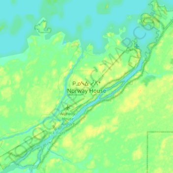
Name: Norway House topographic map, elevation, terrain.

Location: Norway House, Unorganized Division No. 22, Division No. 22, Manitoba, Canada (53.92667 -97.87333 54.00667 -97.79333)

Average elevation: 221 m

Minimum elevation: 214 m

Maximum elevation: 231 m

Division No. 22 trails, hiking, mountain biking, running and outdoor activities

Other topographic maps

Click on a map to view its topography, its elevation and its terrain.

Gear up for your next adventure:

🧶550 Survival Paracord - Versatile utility cord for emergency repairs and rigging
🧥Packable Rain Jacket - Breathable waterproof layer for unpredictable weather
🔋Solar Power Bank - Keep your GPS and devices charged during long outdoor trips
🔪Outdoor Multitool - Versatile tool for repairs and food prep in the wild
🧰Survival Kit - Essential gear for emergencies in the wilderness

As an Amazon Associate, this site earns from qualifying purchases at no extra cost to you.