
Make a donation
Gear up for your next adventure:
As an Amazon Associate, this site earns from qualifying purchases at no extra cost to you.
Tekkeköy topographic map
Click on the map to display elevation.
Make a donation
Gear up for your next adventure:
As an Amazon Associate, this site earns from qualifying purchases at no extra cost to you.
Tekkeköy
The Hacı Osman grove, which stretches along the coast, Kapaklı Pınar, Kırantepe, Azman, and Asarağaç hills at 700 to 800 m altitudes are popular spots for picnicking and other recreational activities.
Make a donation
Gear up for your next adventure:
As an Amazon Associate, this site earns from qualifying purchases at no extra cost to you.
About this map
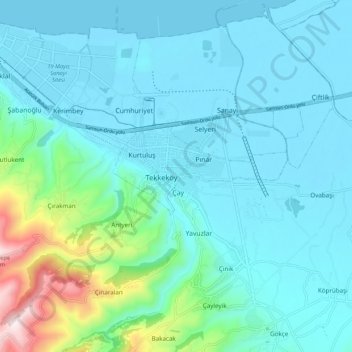
Name: Tekkeköy topographic map, elevation, terrain.
Location: Tekkeköy, Samsun, Black Sea Region, 55300, Turkey (41.17350 36.41780 41.25350 36.49780)
Average elevation: 114 m
Minimum elevation: 0 m
Maximum elevation: 668 m
Make a donation
Gear up for your next adventure:
As an Amazon Associate, this site earns from qualifying purchases at no extra cost to you.