Geolocate

Paraggi topographic map

Click on the map to display elevation.

About this map

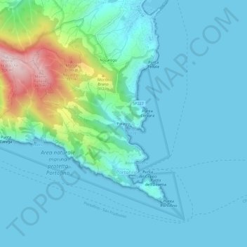
Name: Paraggi topographic map, elevation, terrain.

Location: Paraggi, Santa Margherita Ligure, Genoa, Liguria, 16038, Italy (44.29157 9.18860 44.33157 9.22860)

Average elevation: 72 m

Minimum elevation: -1 m

Maximum elevation: 489 m

Gear up for your next adventure:

🔦LED Headlamp - Hands-free lighting for early morning starts or late finishes
🧢Hiking Hat - Sun-protective and breathable hats for long treks
🥾Lightweight Hiking Boots - Boots for comfort and mobility on long hikes
🩹Moleskin Blister Pads - Direct protection for painful foot pressure points
🥾Waterproof Hiking Boots - Boots keeping your feet dry in wet conditions

As an Amazon Associate, this site earns from qualifying purchases at no extra cost to you.