Geolocate

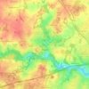
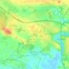
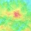
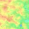
Guérande topographic map

Click on the map to display elevation.

About this map

Name: Guérande topographic map, elevation, terrain.

Location: Guérande, Saint-Nazaire, Loire-Atlantique, Pays de la Loire, Metropolitan France, 44350, France (47.28211 -2.51139 47.38928 -2.31528)

Average elevation: 15 m

Minimum elevation: -3 m

Maximum elevation: 57 m

Other topographic maps

Click on a map to view its topography, its elevation and its terrain.
Le Gravier

France > Pays de la Loire > Loire-Atlantique > Blain

Average elevation: 24 m

Quimiac

France > Pays de la Loire > Loire-Atlantique

Average elevation: 6 m

Quimiac

France > Pays de la Loire > Loire-Atlantique

Average elevation: 6 m

Trembly

France > Pays de la Loire > Loire-Atlantique > Trignac

Average elevation: 2 m

Castre

France > Pays de la Loire > Loire-Atlantique > Pierric

Average elevation: 23 m

La Chainaie

France > Pays de la Loire > Loire-Atlantique > Nozay

Average elevation: 60 m

Forget

France > Pays de la Loire > Loire-Atlantique > Casson

Average elevation: 29 m

Quimiac

France > Pays de la Loire > Loire-Atlantique

Average elevation: 6 m

Gear up for your next adventure:

🥾Hiking Gaiters - Protect legs and shoes from mud, snow, and debris
🎒Backpack Rain Cover - External shield to keep your entire pack dry
🧴Insect Repellent - Protect yourself from bugs during outdoor adventures
🔦UV Flashlight - Detect minerals or specific insects in the dark
🧴Waterproofing Spray - Restore the DWR coating on jackets and tents

As an Amazon Associate, this site earns from qualifying purchases at no extra cost to you.