
Thank you for supporting this site ❤️
Make a donation
Make a donation
Gear up for your next adventure:
As an Amazon Associate, this site earns from qualifying purchases at no extra cost to you.
Ouselle topographic map
Click on the map to display elevation.
Thank you for supporting this site ❤️
Make a donation
Make a donation
Gear up for your next adventure:
As an Amazon Associate, this site earns from qualifying purchases at no extra cost to you.
About this map
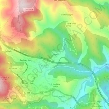
Name: Ouselle topographic map, elevation, terrain.
Location: Ouselle, Becerreá, Os Ancares, Lugo, Galice, 27668, Espagne (42.84495 -7.16791 42.88495 -7.12791)
Average elevation: 650 m
Minimum elevation: 421 m
Maximum elevation: 959 m
Thank you for supporting this site ❤️
Make a donation
Make a donation
Gear up for your next adventure:
As an Amazon Associate, this site earns from qualifying purchases at no extra cost to you.