Geolocate

Abuyod topographic map

Click on the map to display elevation.

About this map

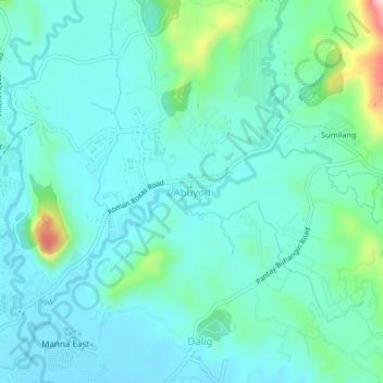
Name: Abuyod topographic map, elevation, terrain.

Location: Abuyod, Teresa, Rizal, Calabarzon, 1879, Philippines (14.56352 121.21016 14.60352 121.25016)

Average elevation: 89 m

Minimum elevation: 45 m

Maximum elevation: 283 m

Other topographic maps

Click on a map to view its topography, its elevation and its terrain.

Teresa River

Philippines > Rizal > Teresa > Bagumbayan

Average elevation: 73 m

Gear up for your next adventure:

🦌Outdoor Trail Camera - Monitor wildlife activity near your favorite spots
🥾Trail Hiking Shoes - Durable shoes designed for rugged trails
🥾Trail Running Boots - Durable shoes designed for trail running
🧥Waterproof Jacket - Lightweight rain jackets for hiking and outdoor activities
🦶Hiking Shoe Insoles - Added support for high arches and long days on feet

As an Amazon Associate, this site earns from qualifying purchases at no extra cost to you.