Geolocate

Porti topographic map

Click on the map to display elevation.

About this map

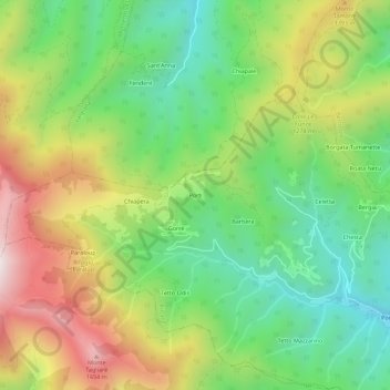
Name: Porti topographic map, elevation, terrain.

Location: Porti, Rittana, Cuneo, Piemonte, 12010, Italia (44.34679 7.33928 44.38679 7.37928)

Average elevation: 1,166 m

Minimum elevation: 796 m

Maximum elevation: 1,710 m

Gear up for your next adventure:

🍽️Titanium Camping Spork - Ultralight and indestructible eating utensil
🥾Mountain Trail Shoes - High-traction shoes for mountain trails
🧴Bear Spray Holster - Quick-access carry for essential Canadian wilderness safety
🥾Approach Boots - Comfortable boots for hiking and climbing approaches
🥾Mountain Hiking Boots - High-traction boots for rocky terrain

As an Amazon Associate, this site earns from qualifying purchases at no extra cost to you.