Geolocate

Cornwall topographic map

Click on the map to display elevation.

About this map

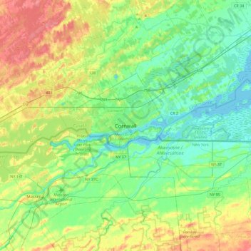
Name: Cornwall topographic map, elevation, terrain.

Location: Cornwall, Eastern Ontario, Ontario, K6H 1Y2, Canada (44.85844 -74.88870 45.17844 -74.56870)

Average elevation: 67 m

Minimum elevation: 44 m

Maximum elevation: 113 m

Cornwall trails, hiking, mountain biking, running and outdoor activities

Gear up for your next adventure:

Camping Essentials - All-in-one gear for a comfortable camping trip
🔋Lithium AA Batteries - Long-lasting power that performs in extreme cold
🧦Thermal Socks - Warm socks for winter hiking or camping
🥾Hiking Shoes - Durable and comfortable shoes for trail hiking
🎒Backpack Rain Cover - External shield to keep your entire pack dry

As an Amazon Associate, this site earns from qualifying purchases at no extra cost to you.