Geolocate

Parandawadi topographic map

Click on the map to display elevation.

About this map

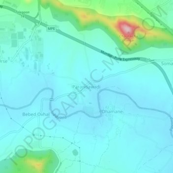
Name: Parandawadi topographic map, elevation, terrain.

Location: Parandawadi, Mawal, Pune District, Maharashtra, 410506, India (18.67805 73.63964 18.71805 73.67964)

Average elevation: 606 m

Minimum elevation: 566 m

Maximum elevation: 839 m

Other topographic maps

Click on a map to view its topography, its elevation and its terrain.

Tung Fort

India > Maharashtra > Mawal

Average elevation: 733 m

Tikona Fort

India > Maharashtra > Mawal > Tikona Peth

Average elevation: 742 m

Pavana Dam

India > Maharashtra > Mawal > Kale Colony

Average elevation: 610 m

Kasarsai

India > Maharashtra > Mawal > Pachane

Average elevation: 654 m

Patan

India > Maharashtra > Mawal

Average elevation: 689 m

Patan

India > Maharashtra > Mawal

Average elevation: 689 m

Gear up for your next adventure:

🦟Insect Repellent - Keep mosquitoes and black flies away in wooded areas
💡Solar Camping Lamp - Eco-friendly lighting for campsites
👖Convertible Hiking Pants - Zip-off legs to adapt to changing weather conditions
🕶️Polarized Sunglasses - Reduces glare from snow and water at high elevations
🛶Kayak Accessories - Essential gear for safe and fun kayaking adventures

As an Amazon Associate, this site earns from qualifying purchases at no extra cost to you.