Geolocate

Mahuli Fort topographic map

Click on the map to display elevation.

About this map

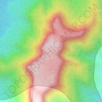
Name: Mahuli Fort topographic map, elevation, terrain.

Location: Mahuli Fort, Shahapur Taluka, Thane, Maharashtra, India (19.49023 73.24959 19.49033 73.24969)

Average elevation: 473 m

Minimum elevation: 120 m

Maximum elevation: 808 m

Gear up for your next adventure:

🧭GPS Tracker - Track your location in remote areas safely
🚲MTB Frame Bag - Carry tools and maps directly on your bicycle frame
🥾Waterproof Trail Shoes - Shoes designed to handle wet terrain
🥾Waterproof Hiking Boots - Essential footwear for rugged terrain and wet Canadian trails
🛁Quick-Dry Microfiber Towel - Space-saving towel that dries rapidly on the move

As an Amazon Associate, this site earns from qualifying purchases at no extra cost to you.