
Ludlow topographic map
Click on the map to display elevation.
About this map
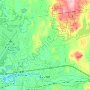
Name: Ludlow topographic map, elevation, terrain.
Location: Ludlow, Hampden County, Massachusetts, 01056, United States (42.15266 -72.52429 42.23185 -72.39525)
Average elevation: 95 m
Minimum elevation: 32 m
Maximum elevation: 242 m
Other topographic maps
Click on a map to view its topography, its elevation and its terrain.
South End
United States > Massachusetts > Hampden County > Springfield > South End
Average elevation: 37 m